

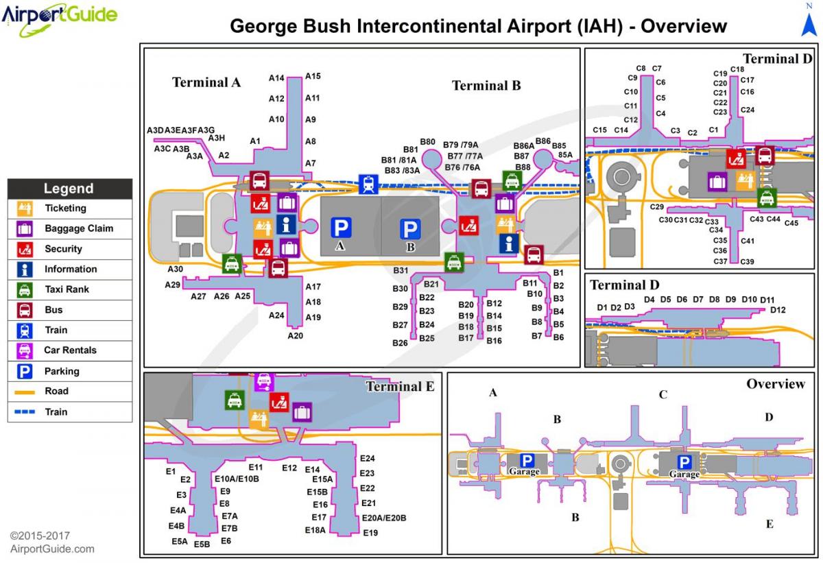
You can find on this page the Houston airports map to print and to download in PDF. The Houston airport map presents terminals and gates of the international airport of Houston in Texas - USA.
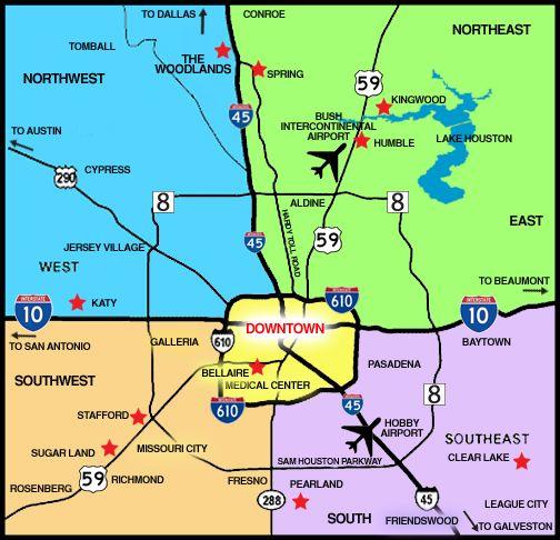
The Houston airports map shows all the airports around Houston. This airports map of Houston will allow you to determine which airport you will used to leave Houston in Texas - USA. The Houston airports map is downloadable in PDF, printable and free.
Houston is served by two commercial airports as you can see in Houston airports map—the largest of which is the George Bush Intercontinental Airport (IAH). The airport is the 7th-busiest in the United States for total passengers, and 16th busiest worldwide. Houston is the headquarters of Continental Airlines, Bush Intercontinental is Continental's largest hub, with more than 750 daily departures (more than 250 of which are Continental flights). Bush Intercontinental currently ranks second in the United States for non-stop domestic and international service (221 destinations), trailing only Atlanta Hartsfield with 250 destinations. The United States Department of Transportation has also recently named Bush Intercontinental one of the top ten fastest growing airports in the United States.
The second-largest commercial airport in Houston is the William P. Hobby Airport as its mentioned in Houston airports map (named Houston International Airport until 1967). The airport operates primarily small to medium-haul flights and is the only airport in Houston served by Southwest Airlines and JetBlue Airways. The third-largest airport and former U.S. Air Force base, Ellington Airport (formerly Ellington Field), is primarily used for government and private aircraft. At one point, Continental Express operated flights across the city to Bush Intercontinental primarily for residents of southeast Houston and Galveston County. Passenger flights ended on September 7, 2004.
The Federal Aviation Administration and the state of Texas selected the Houston Airport System, which manages Bush, Hobby, and Ellington, as Airport of the Year for 2005, largely because of its multi-year, $3.1 billion airport improvement program for both major airports in Houston. Andrau Airpark as its shown in Houston airports map, a privately-owned airport, was located in Houston until 1998; it was demolished and as of 2008 contains the Royal Oaks Country Club subdivision. The Houston Air Route Traffic Control Center stands on the George Bush Intercontinental Airport grounds.

The map of Houston airport presents the main international airport of Houston. This international airport map of Houston will allow you to determine by which terminal and gate you will arrive or leave Houston in Texas - USA. The airport Houston map is downloadable in PDF, printable and free.
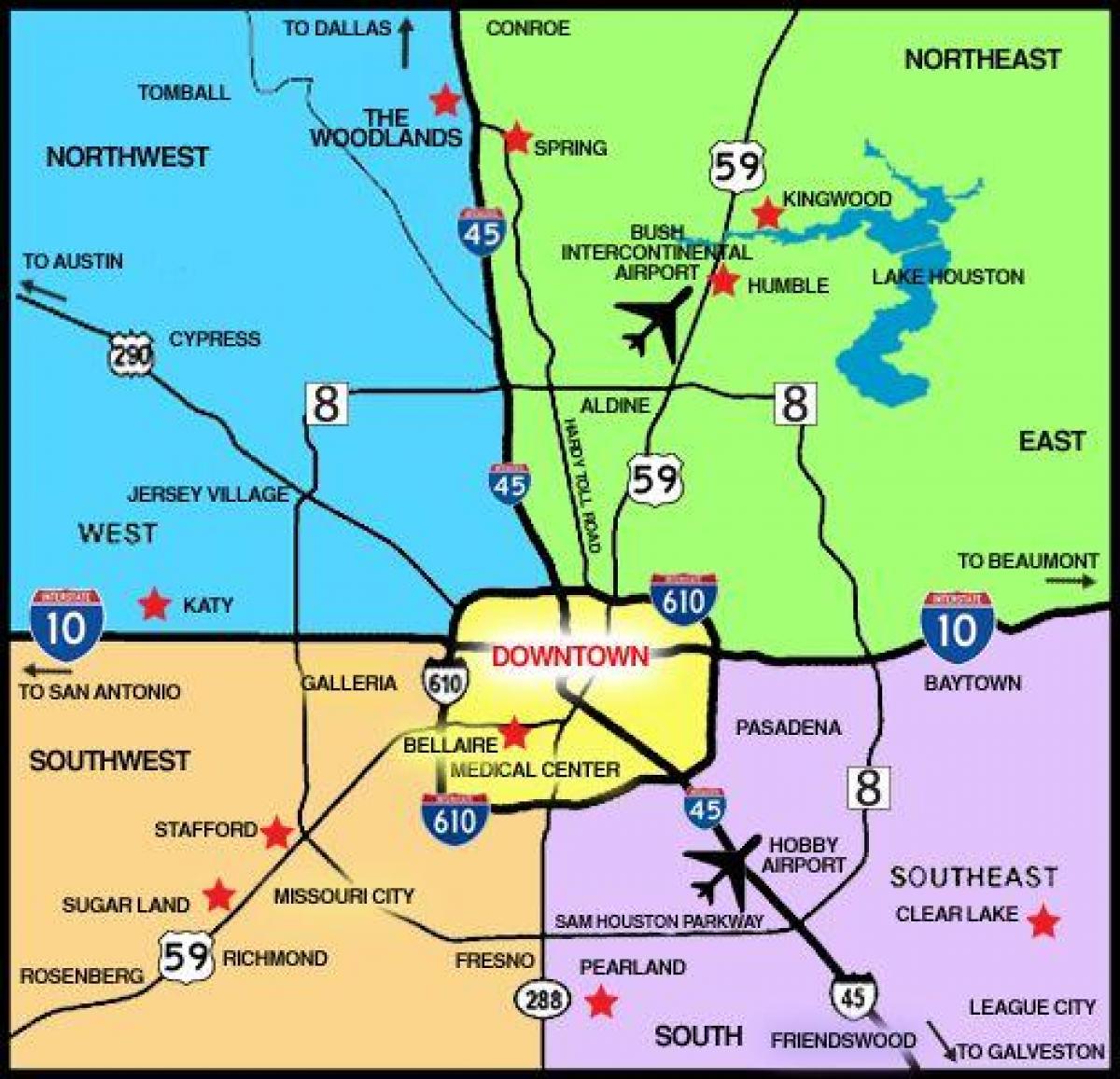
George Bush Intercontinental Airport, (IATA: IAH, ICAO: KIAH, FAA LID: IAH) is a Class B international airport in Houston, Texas--the United States fourth largest populated city, and serving the Houston–Sugar Land–Baytown metropolitan area, the fifth-largest metropolitan area in America. Located about 23 miles (37 km) north of Downtown Houston, between Interstate 45 and U.S. Highway 59 as you can see in Houston international airport map, George Bush Intercontinental Airport has scheduled flights to domestic and international destinations. The airport is named after George H. W. Bush, the 41st President of the United States. The airport houses an on-site hotel, a Marriott, between Terminals B and C and is accessible via the inter-terminal train. The hotel has 566 rooms, two restaurants, a cocktail lounge, a coffee shop and a conference center.
George Bush Intercontinental Airport served 40,170,844 passengers in 2011 making the airport the tenth busiest for total passengers in North America as its mentioned in Houston international airport map. In 2006, the airport was named the fastest growing of the top ten airports in the United States by the United States Department of Transportation. Houston Bush Intercontinental is the largest hub for United Airlines with an average of 800 daily departures. The airport currently ranks third in the United States for non-stop domestic and international service with 182 destinations, trailing Chicago O'Hare International Airport with 192 destinations and Hartsfield-Jackson Atlanta International Airport with 239 destinations.
There are three main entrances into IAH terminal areas. John F. Kennedy Boulevard is the main north-south artery into the airport and intersects with Greens Road becoming an expressway leading to the terminals (by traveling east on Greens Road, one can access the nearby Greenspoint business and residential district). Will Clayton Parkway, which runs east to west, is another main road for IAH. The Hardy Tollway Connector runs from west to east connecting JFK Boulevard to the Hardy Toll Road. An above ground train called TerminaLink connects Terminals A, B, C, D, E and the International Arrivals Building (IAB) as its shown in Houston international airport map, for those with connecting flights in different terminals and provides sterile airside connections. This allows passengers to travel within the airport without having to re-enter security. TerminaLink has four stops: Terminal A, Terminal B, Terminal C, and Terminals D/E including the IAB.